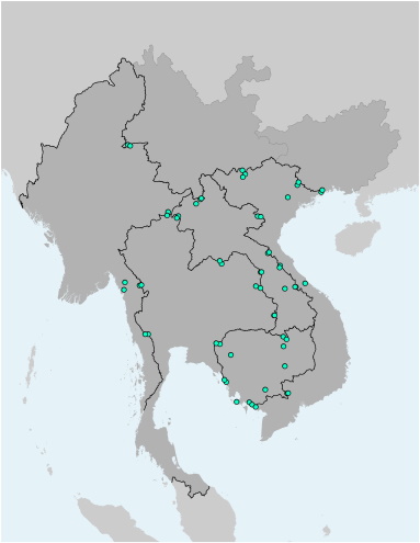
This file contains the locations (points) of towns along the GMS Economic Corridors. It further details out their name, the type of the city/town, which of these towns are part of the Corridor Town Development Project (CTDP), and which of these towns are part of the Cross Border Economic Cooperation (CBT). The file is available as Shapefile (for use with Desktop-GIS software) and KMZ (for use with Google Earth).
GMS Economic Corridors - Towns in Corridor Town Development Project (CTDP) and Towns in Cross Border Economic Cooperation (CBT)
Corridors Towns
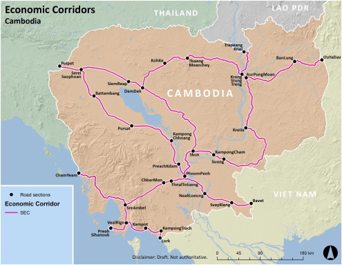
GMS Economic Corridors Cambodia - Main Corridors
Corridors Towns
Map of the alignment of the Greater Mekong Subregion Southern Economic Corridor (SEC) in Cambodia
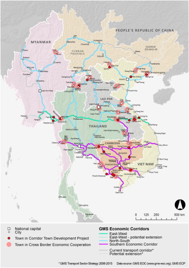
GMS Economic Corridors - Towns in Corridor Town Development Project (CTDP) and Towns in Cross Border Economic Cooperation (CBT)
Corridors Towns
Overview map of important towns along the Greater Mekong Subregion Economic Corridors, including information on their prticipation in the Corridor Town Development Project (CTDP) and the Cross Border Economic Cooperation (CBT).


