GMS Economic Corridors - Roads with attributes
Economic Corridors
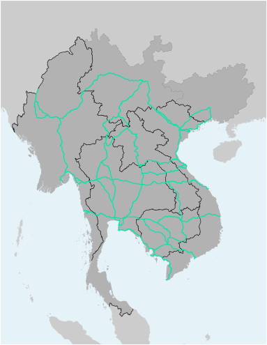
GMS Economic Corridors - Roads with attributes
This file contains the alignments (polyline) of all GMS Economic Corridors. Each corridor is subdivided into sections (named by start and end point), for which additonal information is available: the name of the sub-corridor, road class, number of lanes, road condition and road surface. The file is available as Shapefile (for use with Desktop-GIS software) and KMZ (for use with Google Earth).
| Attachment | Size |
|---|---|
| 2.05 MB | |
| 1.49 MB |
Version Date: November 2018
Last Updated:
7
October
2020