 |
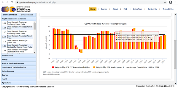
GMS StatisticsEasy-to-use website providing interactive and customizable access to the GMS Statistical Database. |
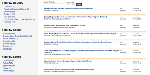 |
Projects DatabaseIntroduction to the GMS project pipeline, including search function to quickly find projects of interest. |
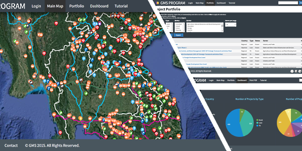 |
Project Webmap and DashboardWebsite of the GMS project database blending together interactive maps, live statistics, and online collaboration functions. |
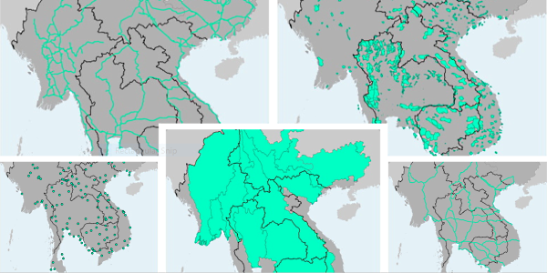 |
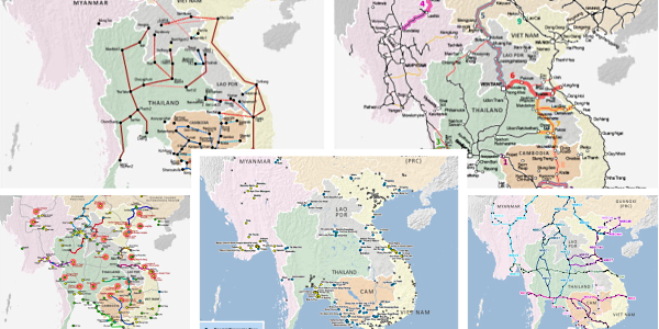
Map LibrarySelection of ready-made maps of the GMS, for use in presentations and publications. |
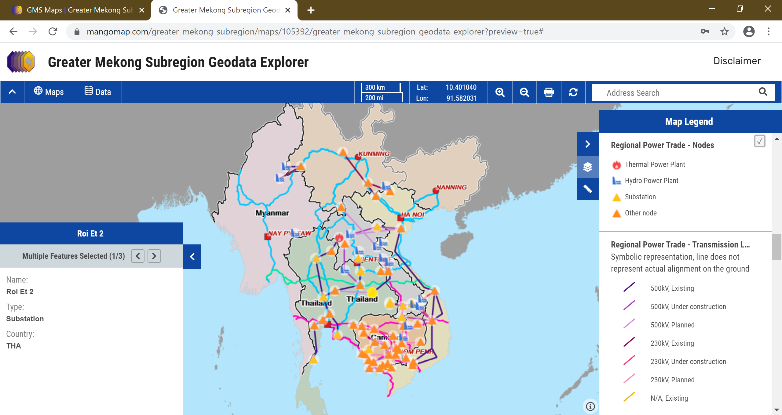 |
Geodata Explorer – Regional VersionPlatform to interactively select, browse, query, and make your own maps, from a wide range of geodata on the GMS, without the need for technical skills or software. This version is optimized for the development of regional and transboundary maps. |
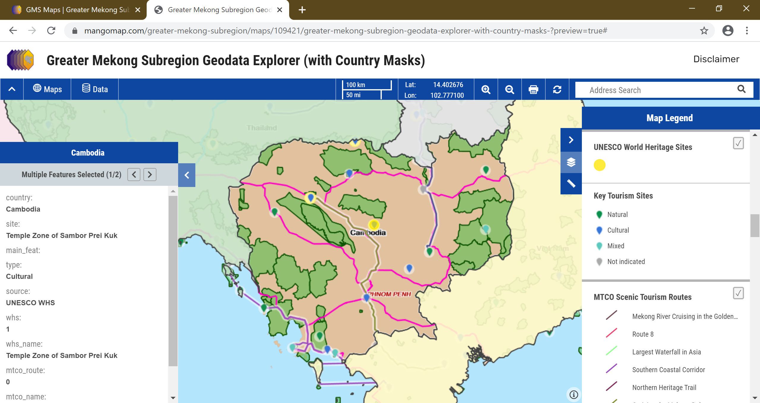 |
Geodata Explorer – Country VersionPlatform to interactively select, browse, query, and make your own maps, from a wide range of geodata on the GMS, without the need for technical skills or software. This version is optimized for the development of country maps. |
 |
Geodata LibrarySelection of geographic data of the GMS giving users a maximum of customization and analytical options. Provided formats include ESRI Shapefile (for use in GIS software) and Google KMZ file (for use with Google Earth). |
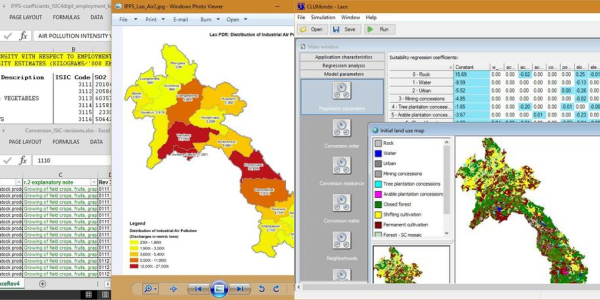 |
ToolsSelection of innovative statistical and spatial tools adapted to support integrated development and investment planning in the GMS. |